Check out a full video summary of the journey here!
Click here for trail notes and photos!
Several months ago, my close friend Shane Grace approached me with a dubious proposition. Shane had found Steve Roper's Sierra High Route and through osmosis, this curiosity was instilled in me as I was pitched more information about the trek.
In his words: “I found out about [The High Route] when I met a couple doing a section of it on top of Muir Pass last year while on the John Muir Trail. After loving my experience on the JMT I googled it right away when I got home. After researching the JMT for so long I was surprised and confused by how little information there was on The High Route and just put it in the back of my mind. It kept popping back up so I ordered Roper’s guidebook and began reading. The whole spirit of the route sounded like the perfect next step of progression after a solid intro to backpacking. The initial interests were the lack of people, the grandeur of the places it went through, and the difficult nature of it (and those crazy topo lines on the map).”
At first I didn’t think much. Shane often comes to me with trip ideas. Wild fascinations of backcountry routes in (insert national park here),a road trip crossing several states, or a surf trip up the coast of California are not uncommon topics of conversation between Shane and I. The thirst for adventure and passion for finding new, wide open places is alive and well in Shane, and as a consequence of my association with him, I am often dragged (without considerable force or persuasion) along to some of the most incredible places in the country.
Shane and I have been friends for a fairly long time now, meeting originally through our joint passion for surf and landscape photography. We would often would see each other at the popular beach-break locales of Southern California: The Wedge, Crescent Bay, and Seal Beach to list a few. Our friendship developed naturally, surrounding the central themes of water, light, and adventure. We are both at the exciting stages in our lives. Adulthood is pending in the not-too-far-off future, but in actuality the responsibility and seriousness of “real life” has not fully come into fruition. I am 20 years old and starting my sophomore year at Santa Clara University. Shane is 22 years old, freshly graduated from The University of Hawaii. We are both young, naive, and wild with creative passion. We love our lives, comprised of balancing school, family, adventure, and monetary endeavors. Often, I picture jugglers in a family circus when I step back and reflect on our lifestyle. We are kind of all over the place. Exciting times lie ahead of both of us and The Sierra High Route came at the perfect moments in our lives.
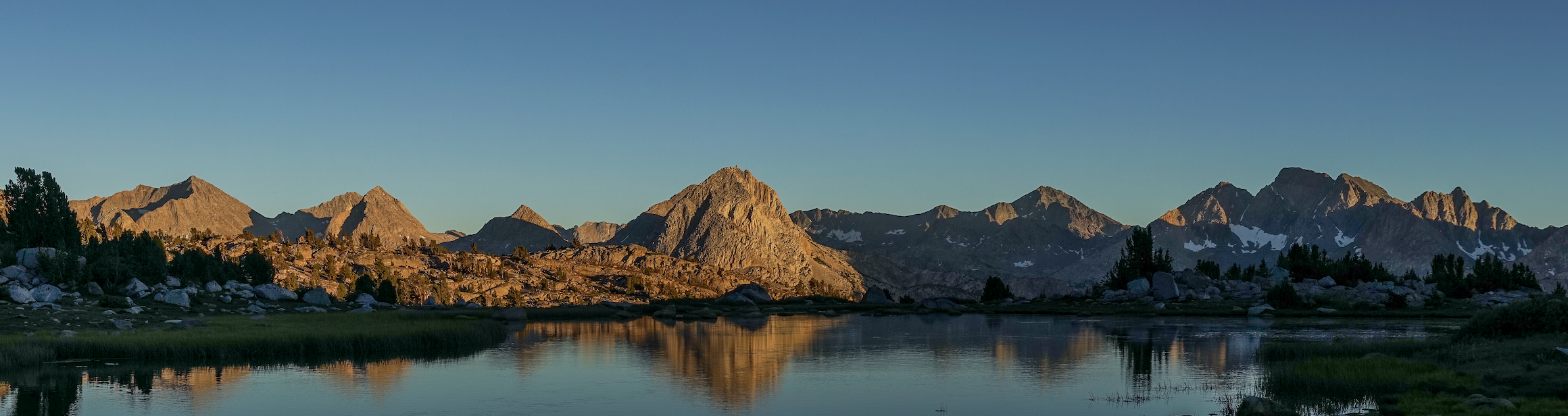
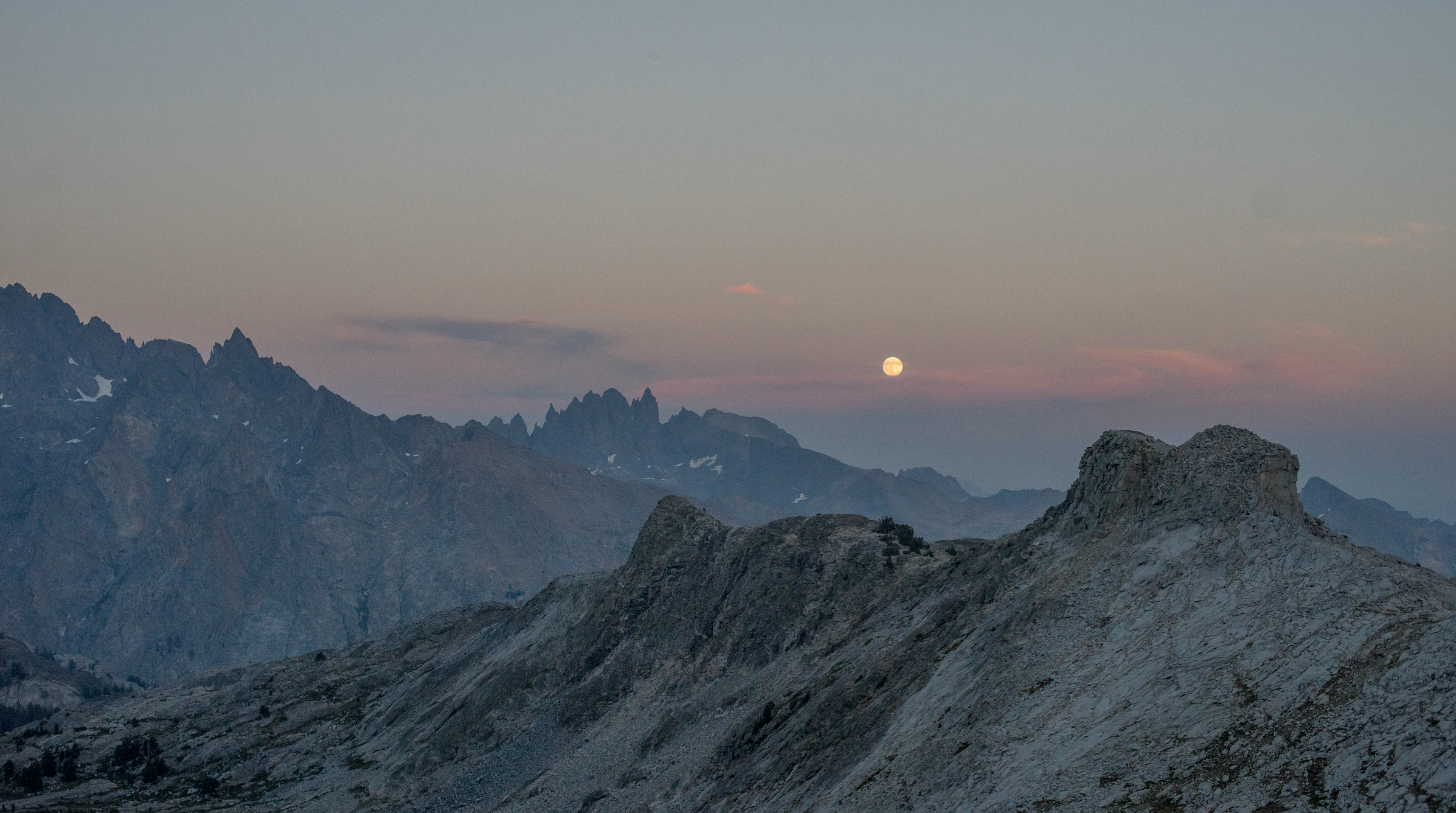
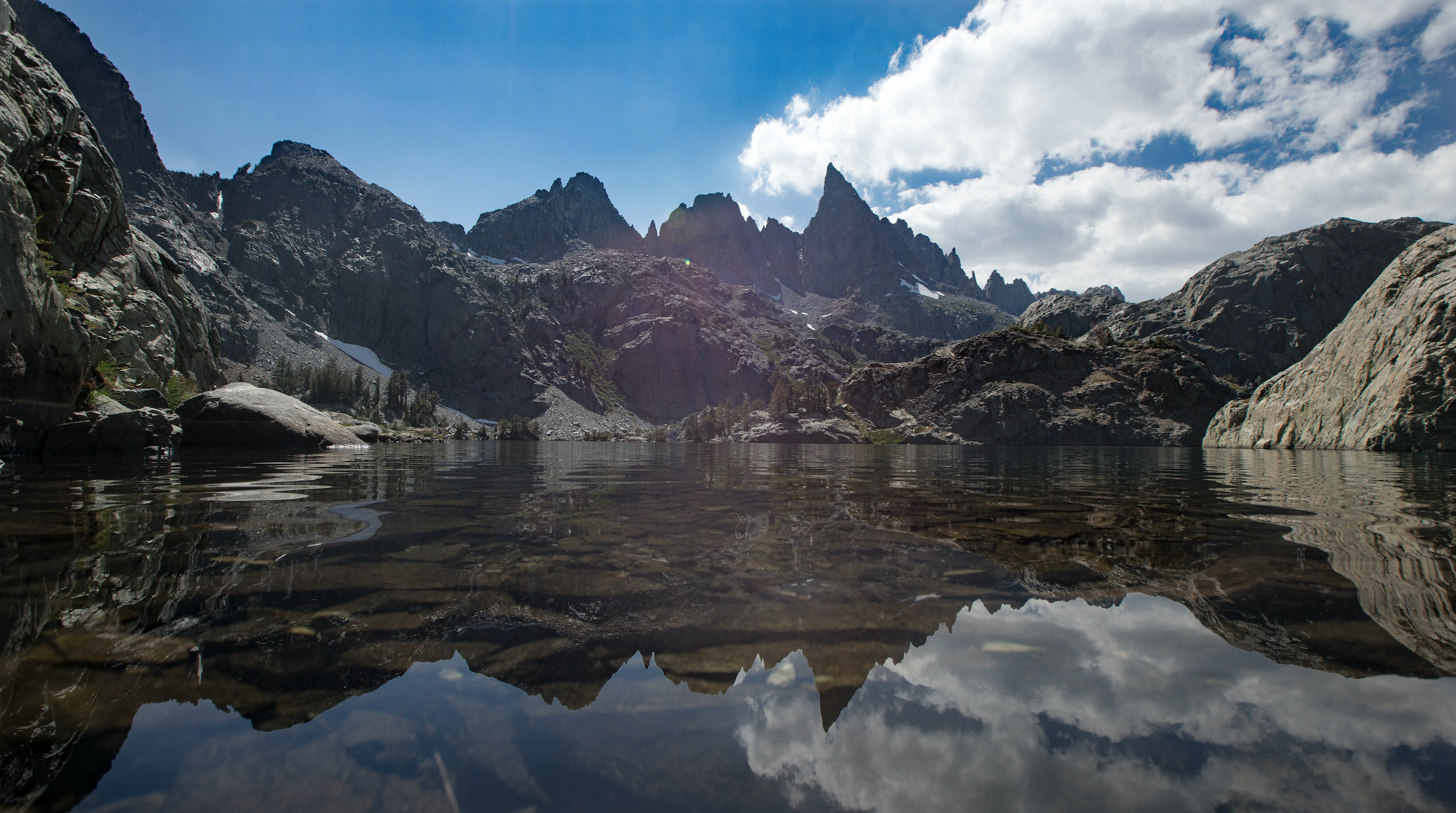
The Sierra High Route (sometimes referred to as “The Roper Route) is a 200-220 mile trek that spans much of The Sierra Nevadas. The route was dreamed up by a man named Steve Roper, an acclaimed Yosemite rock climber, Sierra mountaineer, and writer. He has written several books and guidebooks, his most famous being Camp 4: Recollections of a Yosemite Rockclimber. Much of The High Route parallels the famous (and, in my opinion, overcrowded) John Muir Trail. While dreaming up the High Route, Roper wanted to design a trek that would allow adventurous hikers without any mountaineering experience to enjoy the upper reaches of the timberline country, mainly fluctuating between 9,000 and 11,500 feet. Since much of the route is above the tree line, vast panoramic views are available everywhere on the route.
Overview of the trek:
The Sierra High Route Wikipedia page actually sums it up nicely. (Click bolded for link)
Cirque Country: Cedar Grove to Dusy Basin, traversing the Monarch Divide, Lake (Cartridge Creek) Basin, Upper Basin, Palisades Basin, Barrett Lakes Basin, and Dusy Basin.
Whitebark Country: Dusy Basin to Lake Italy, through LeConte Canyon, Muir Pass, Evolution Basin, the Glacier Divide, Humphrey's Basin, and Bear Lakes Basin.
Lake Country: Lake Italy to Devils Postpile by way of Bear Lakes Basin, Mono Lakes Basin, the Recesses, the Silver Divide, and the Mammoth Crest.
Headwaters Country: Devil's Postpile to Tuolumne Meadows, crossing the Ritter Range and the Cathedral Range.(Roper calls this "Headwaters Country" because the route crosses headwaters of the San Joaquin River.)
Canyon Country: Tuolumne Meadows to Twin Lakes through Yosemite's north country.
From south to north (the direction Roper recommends hiking it), the Sierra High Route passes through Kings Canyon National Park, the Inyo National Forest, and Yosemite National Park.
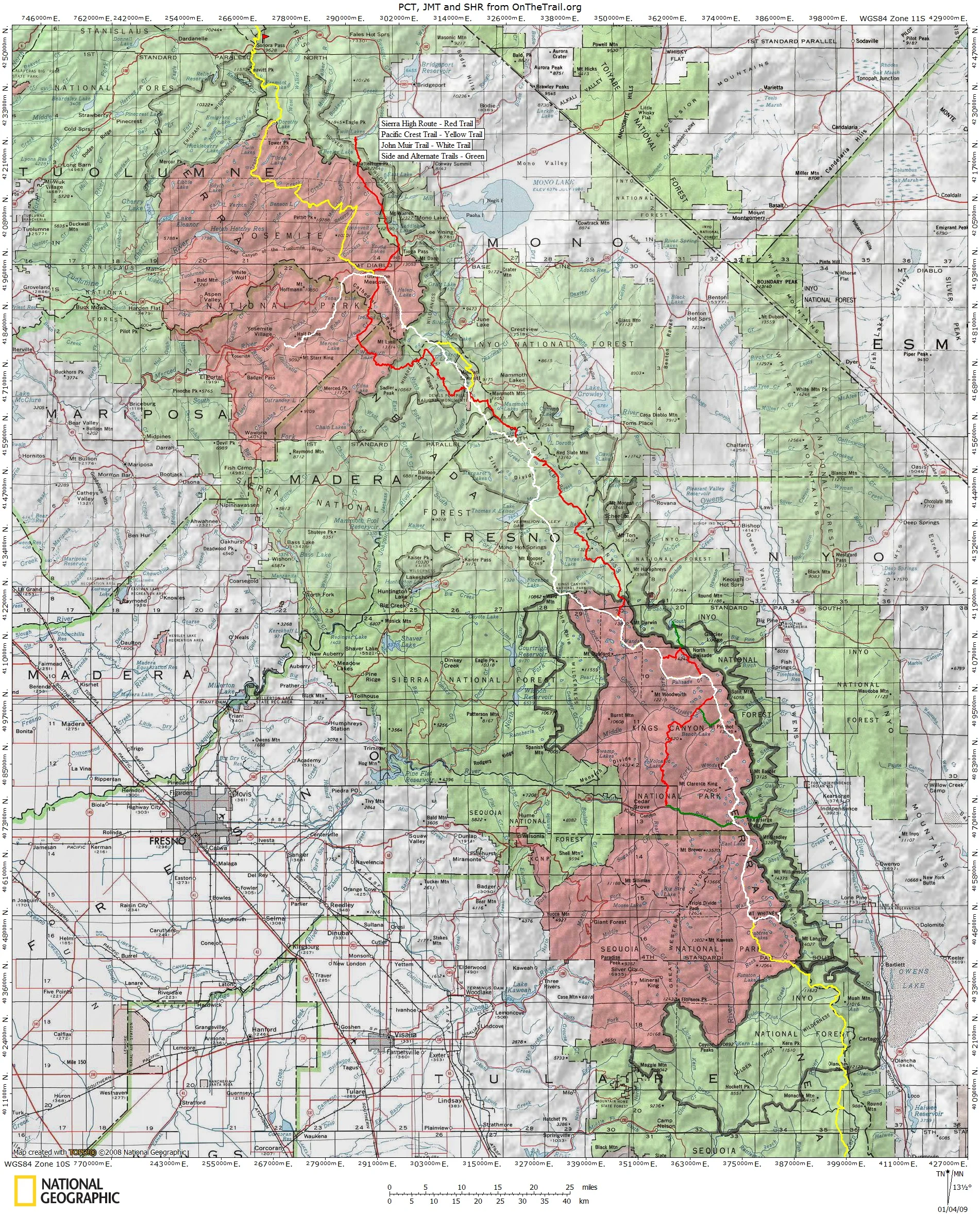
Follow the red “trail” (Keep in mind the SHR is NOT a trail but a route)
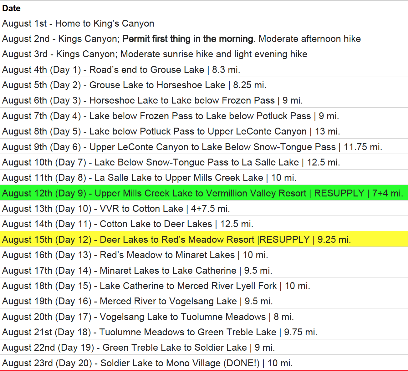
Our full itinerary